The Laurissilva Forest: Madeira's Ancient Rainforest Explained
What is the Laurissilva forest in Madeira?
It is a relic laurel forest that once covered much of Mediterranean Europe before the last Ice Age and survives today mainly on Madeira's north slope, covering around 15,000 hectares. It has been a UNESCO World Heritage Site since 1999 and is the largest surviving area of this forest type anywhere in the world.
Most visitors to Madeira walk through the Laurissilva without ever being told what it actually is. They come for a levada, a waterfall, a photograph at Fanal, and they leave believing they have seen “a forest” in the way that any green, damp, tree-covered hillside is a forest. That is the single biggest thing this guide wants to correct. The Laurissilva is not a forest that happens to be old.
It is a relic: a surviving fragment of a vegetation type that dominated huge parts of Mediterranean Europe and North Africa before the climate shifted and the ice ages arrived, wiping it out almost everywhere except a handful of Atlantic islands where the ocean kept conditions stable enough for it to hang on. What you are walking through on a Madeira levada path is, in botanical terms, closer to a living fossil than to an ordinary woodland.
What “Laurissilva” actually means
The name comes from Latin: laurus (laurel) and silva (forest). It describes forests dominated by broad-leaved, evergreen trees in the laurel family and related genera, adapted to constant humidity, mild temperatures and very little seasonal variation. This is not the deciduous forest of northern Europe that turns brown and drops its leaves every autumn, and it is not tropical rainforest either. It is something in between, tuned specifically to the mild, wet, fog-fed conditions of subtropical Atlantic islands.
Before the Quaternary ice ages, laurel forest of this general type covered large stretches of the Mediterranean basin. As the climate cooled and dried, the forest retreated and, on the European and North African mainland, effectively disappeared. It survived only where the Atlantic kept conditions close to what it needed: humid, frost-free, and buffered by the ocean. That narrow shortlist of refuges is why Laurissilva today exists in only a few small, scattered pockets: fragments in the Azores, the Canary Islands, and a much smaller patch near Sintra on the Portuguese mainland. None of them come close to the scale or intactness of what survives on Madeira.
Why Madeira has so much of it left
Madeira’s north slope is the reason. The island sits in the path of the Atlantic trade winds, and its central mountain ridge, running up to Pico Ruivo at 1,862 metres, forces moist air upward on the northern side, where it cools and drops its water as rain and, just as importantly, as fog that condenses directly onto leaves and moss. The south, in the rain shadow, dried out early and was cleared for agriculture and settlement from the 15th century onward. The north stayed wet, steep and difficult to farm, which is precisely what left its forest largely undisturbed.
Today the Laurissilva covers around 15,000 hectares of Madeira, which works out to nearly a fifth of the entire island’s land area concentrated mostly on that north-facing slope, from around 300 to 1,300 metres in altitude. It is the largest surviving area of this forest type anywhere on Earth, and UNESCO recognised exactly that when it inscribed the forest as a World Heritage Site in 1999, citing it as an outstanding relic of a laurel forest type that has otherwise almost vanished.
It is worth being precise about the word “relic” here: this is not marketing language. In conservation terms it means a surviving remnant of an ecosystem whose original range has collapsed, which is a fundamentally different thing from an old-growth forest that has simply never been logged.
How old is it, really
There are two different timescales worth separating, because guides and signage often blur them together.
The forest type is tens of millions of years old, dating to the Tertiary period, long before Madeira itself existed as an island. Madeira is volcanic and emerged from the seabed roughly five million years ago; the Laurissilva vegetation type predates the rock it now grows on. In other words, the forest did not evolve on Madeira. It arrived, adapted from an already ancient lineage, and survived here after being erased almost everywhere else.
Individual trees within the forest are a separate matter, and this is where Madeira’s most photographed corner comes in. At Fanal, on the Paul da Serra plateau, stand til trees (Ocotea foetens), one of the four dominant Laurissilva species, whose trunks have been shaped over centuries by constant wind and moisture into low, twisted, almost sculptural forms. Many of these individual trees are genuinely several hundred years old. That combination, an ancient forest type made up of centuries-old individual trees, is what separates the Laurissilva from a merely picturesque woodland, and it is the detail worth remembering when a description reduces it to “a lovely misty forest.”
The four defining tree species
Botanists generally define Madeira’s Laurissilva by four dominant broad-leaved evergreen species, all members of the laurel family or closely related:
| Species | Common name | Notes |
|---|---|---|
| Laurus novocanariensis | Til-laurel / Madeira laurel | Gives the forest its name |
| Ocotea foetens | Til | The iconic gnarled trees of Fanal |
| Persea indica | Vinhático | Valued historically for timber |
| Clethra arborea | Folhado | Distinctive white flower spikes |
These species form a closed, multi-layered canopy that traps humidity beneath it, which in turn supports a dense understorey of ferns, mosses and endemic flowering plants found nowhere else on Earth. That layering is part of what makes the forest function as a water system, not just a habitat, which is the next thing worth understanding.
The Laurissilva and the levadas: how the forest feeds the water system
This is the part most descriptions of the Laurissilva leave out entirely, and it matters, because it explains why the forest is not just scenic but functional to the island’s water supply.
The north slope of Madeira receives heavy rainfall, but the Laurissilva canopy does more than sit under it. The dense leaf cover and moss layer intercept low cloud and fog directly, condensing moisture out of the air even when it is not actively raining, a process sometimes called horizontal precipitation. That water then percolates slowly through the forest floor’s thick organic layer rather than running straight off the mountainside, feeding streams and springs at a steady, regulated rate through the year rather than in sudden floods followed by dry spells.
That steady, filtered water supply on the wet north side is exactly what 15th-century settlers needed to solve a very different problem: the south side of the island, where they wanted to grow sugar cane and later bananas and grapes, was dry. Their answer was the levada network, a system of gravity-fed channels, eventually running to more than 2,000 kilometres, dug largely by hand from the century after settlement onward to carry water from the humid north to the cultivated south.
Many of the levadas that hikers now walk for the scenery, including the best-known routes to Caldeirão Verde and the 25 Fontes, draw their water from streams that begin, and are sustained, inside the Laurissilva. Walk one of these paths and you are, in effect, walking alongside the endpoint of a water cycle that starts in the canopy overhead.
This is also why the forest’s conservation is not a purely aesthetic concern. Degrade the Laurissilva and you do not just lose scenery; you disrupt the slow, regulated water supply that the levada system, and by extension much of Madeira’s agriculture, was built around from the start.
Where to actually see it
There is no single “Laurissilva viewpoint.” The forest reveals itself differently depending on where you enter it.
Fanal, at the north-western edge of the Paul da Serra plateau, is the place most associated with the forest in photographs: open glades of ancient, low, wind-twisted til trees, frequently wrapped in cloud. It has its own dedicated guide covering its specific misty, sculptural character, its access and the honest caveat that without fog it is simply a pasture with old trees rather than the ethereal scene most people expect; that guide is the place to plan a Fanal visit properly rather than repeating it here.
Caldeirão Verde, reached from the Queimadas forest park, shows the Laurissilva at its densest and most closed-in: a narrow valley walk through unbroken canopy, several unlit tunnels, and a waterfall dropping into a green pool at the end.
Rabaçal and the 25 Fontes, reached by a shuttle from the car park since the access road is closed to private cars, sit at the heart of the largest continuous block of the forest, with paths threading between streams and fern-lined channels.
Ribeiro Frio and the short walk to the Balcões viewpoint offer one of the easiest ways to stand inside the forest and also see it from outside, looking across the canopy toward the central peaks.
Each of these is covered by its own dedicated route guide with distances and practical detail; this page is about what the forest is, not a trail-by-trail breakdown.
Guided routes into the forest
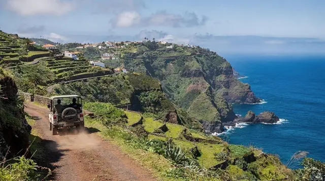
Because the Laurissilva sits away from the main road network on the north slope, most visitors see it either by driving to a trailhead and walking a levada independently, or by joining a guided route that handles transfers and route-finding. A guided walk through the Laurissilva paired with a traditional lunch is a straightforward way to get an explained introduction to the forest without planning logistics yourself.
For Fanal specifically, a guided PR13 hike to Fanal with transfer included solves the awkward access problem, since Fanal has no public transport link and limited parking.
Those who want to combine the forest with the island’s wider north coast in a single day can look at a private full-day tour covering the north coast and the Laurissilva forest, while a more demanding option is the full-day hike from Ribeiro Frio to Portela, which spends most of its distance inside the forest proper rather than skirting its edge.
What not to expect
It is worth being direct about what the Laurissilva is not, because expectations set by photographs of Fanal on a misty day do not match most of what a visitor actually walks through. Large stretches of the forest, particularly along the busier levada paths, are simply dense, green, humid woodland: beautiful in its own way, but without the ghostly, wind-sculpted drama of Fanal’s open glades. Fog at Fanal is not guaranteed on any given day, and the same walk in clear sun looks like an ordinary hillside pasture with old trees rather than the otherworldly scene most visitors expect; that trade-off is explained fully in the Fanal guide rather than repeated here.
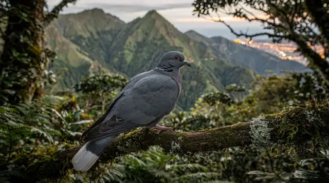
It is also worth separating the forest from its wildlife. The Laurissilva shelters species, particularly birds and invertebrates, found nowhere else in the world, and their specific ecology, where to look and what to listen for is covered in a dedicated wildlife guide rather than here. This page focuses on the forest as a geological and historical fact: an ancient relic ecosystem and a working part of the island’s water system, not a wildlife checklist.
Visiting responsibly
The Laurissilva’s protected status is not symbolic. Since August 2021, access to the official waymarked trails, the PR-numbered paths that thread through much of the forest, requires a paid, pre-booked permit through the government’s official booking system, checked at trail control points. This funds trail maintenance and erosion control in a forest that took millions of years to reach its current state and cannot simply regrow if damaged by careless use. Staying on marked paths, not picking plants, and checking trail status before setting out, since paths do close after heavy rain and landslides, are not bureaucratic formalities here; they are how a forest this old and this rare stays intact for the next visitor.
Frequently asked questions about the Laurissilva forest
What is the Laurissilva forest in Madeira?
It is a relic laurel forest that once covered much of Mediterranean Europe before the last Ice Age and survives today mainly on Madeira’s north slope, covering around 15,000 hectares. It has been a UNESCO World Heritage Site since 1999 and is the largest surviving area of this forest type anywhere in the world.
How old is the Laurissilva forest?
The forest type itself dates back to the Tertiary period, tens of millions of years before Madeira’s volcanic island even existed. Individual til trees within it, particularly around Fanal, are commonly several centuries old, their trunks twisted by wind and moisture into shapes found nowhere else.
Why is the Laurissilva a UNESCO World Heritage Site?
UNESCO inscribed it in 1999 because it is the largest and best-preserved remnant of a forest type that has almost entirely vanished elsewhere. Similar laurel forests survive only in small fragments on the Azores, the Canary Islands and the Portuguese mainland’s Sintra hills, none as extensive or intact as Madeira’s.
Can you visit the Laurissilva forest?
Yes, on foot along the levada paths that run through it, most famously toward Caldeirão Verde, the 25 Fontes and Rabaçal, and the forest at Fanal. There are no roads through the core forest and no shortcuts to seeing it; walking the levadas is how visitors experience it.
Is the Laurissilva forest the same as the levadas?
No. The levadas are irrigation channels built from the 15th century onward to move water out of the forest to the farmland below; the Laurissilva is the forest itself, which the levadas were built to draw from. The paths run through the forest, but the forest predates the channels by millions of years.
What is the best place to see the Laurissilva forest?
Fanal, on the Paul da Serra plateau, is the single most distinctive spot for its ancient, wind-bent til trees and frequent low cloud. The Caldeirão Verde and 25 Fontes walks show the forest at its densest and greenest, in its steep, water-carved valleys.
What animals live in the Laurissilva forest?
The forest shelters species found nowhere else, including endemic birds and invertebrates adapted to this exact habitat. Wildlife is covered in full in a dedicated guide rather than here, since the forest’s ecology and its geology and history are separate subjects worth their own space.
Does it rain a lot in the Laurissilva forest?
Yes, and that is the entire reason it exists where it does. The north slope catches the moisture-laden trade winds, and the forest canopy condenses further water out of passing cloud, which is what keeps the whole system, and the levadas that were built to carry its water south, running.
tours.laurissilva-nature
Verified deep-linked GetYourGuide tours. Book through these links and we earn a small commission at no cost to you.
GetYourGuide does not provide a product photo for this activity — the image shows the meeting point, photographed by us.