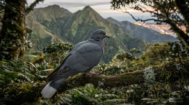
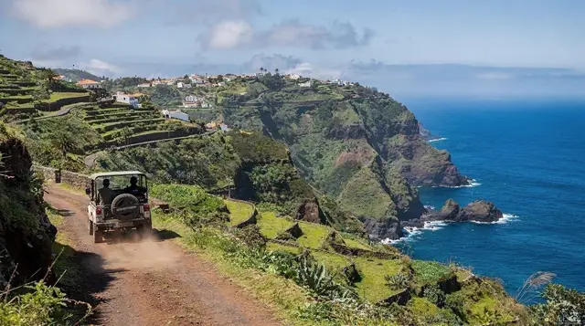
Fanal Forest
Will I see Fanal in the mist?
Not necessarily. Fanal's famous fog is common but never guaranteed — it depends on cloud pushing up from the north coast onto the Paul da Serra plateau on the day you visit. Autumn and winter mornings improve the odds, but plenty of visitors arrive under clear skies and find an ordinary, if striking, hillside pasture instead.
A Grove That Depends on the Weather
Fanal is a small stand of ancient til trees on the north-western corner of the Paul da Serra plateau, and it is, by some margin, the most photographed spot in Madeira. Search the island’s name and within a handful of results you’ll find the same image: low, twisted trunks standing in a field, each one dissolving into white a few metres up, as if the forest simply runs out of definition. It’s an extraordinary picture, and it’s entirely genuine — but it is also entirely dependent on the weather doing something it does often, not something it does always.
This page is about that gap between the photograph and the visit. It covers what Fanal actually is, how to get there, when the fog is more likely to show up, and — because it matters more than any other single fact about this place — what you’ll find if it doesn’t. For the wider forest these trees belong to, see the separate guide to Madeira’s Laurissilva; for the plateau Fanal sits on, see the Paul da Serra page. This one stays narrowly on Fanal itself.
What Fanal Actually Is
The trees at Fanal are Ocotea foetens, known locally as til, one of the four laurel species that make up the Laurissilva — the relic forest that has grown continuously on Madeira’s northern slopes since long before the last ice age, and which UNESCO recognised as a World Heritage Site in 1999 for being the largest surviving example of its kind anywhere. Lower down the island, in sheltered valleys, til grows tall and relatively straight.
At Fanal, on an open plateau at roughly 1,000 metres with almost nothing to break the Atlantic wind, the same species has been shaped over centuries into low, gnarled, near-horizontal forms — trunks that lean, split, and creep sideways along the ground before rising again. That shape, not the species itself, is what makes Fanal distinctive within the Laurissilva rather than simply a fragment of it.
The area functions as working pasture as much as protected forest. Cattle graze between the trees, tracks are unpaved and rutted in places, and there is no visitor infrastructure to speak of — no centre, no café, no marked interpretive trail looping through the best specimens. What you get is a working landscape that happens to contain some remarkable old trees, which is part of why the honest version of Fanal differs so much from the postcard version.
The Fog: What It Actually Takes
Fanal’s mist isn’t decorative — it’s orographic cloud, the same mechanism that keeps the island’s north coast consistently greener and wetter than the south. Moist Atlantic air moves in against Madeira’s northern slopes, is forced upward, cools, and condenses into cloud that banks up against high ground. The Paul da Serra plateau, sitting broadly across the island’s centre-west, catches a good deal of this cloud, and Fanal, on its exposed north-western edge, catches more of it than most. On a day when that mechanism is working, the grove disappears into shifting white within minutes, and the twisted trunks read exactly as the photographs promise.
On a day when it isn’t working — a dry, high-pressure spell, or simply an afternoon when the cloud has burned off or hasn’t formed yet — Fanal is a field. A genuinely interesting field, with old, strangely shaped trees and grazing cattle and long views across the plateau when the sky is clear, but not the ethereal scene that drew you there. Neither version is more “real” than the other; they’re both Fanal on different days. What isn’t honest is presenting the misty version as the default, which is what most photographs — cropped and selected precisely because the fog showed up — quietly do.
If there’s a single rule for managing expectations, it’s this: treat any online photo of a fog-wrapped Fanal as evidence that the fog is possible, not that it’s likely on your particular morning. For a broader sense of the island’s weather patterns and how the north differs from the south, Madeira’s mountain weather guide and the best time to visit page both help set realistic expectations before you commit a morning to the drive.
Improving Your Odds, Honestly
There’s no way to guarantee fog at Fanal, but there are patterns worth knowing. Autumn and winter — roughly October through March — see cloud bank up against the north coast more consistently than the drier summer months, so those seasons statistically improve your odds, and the guide to Madeira in winter covers the trade-offs of visiting then.
Early morning is generally more reliable than mid-afternoon, since cloud often forms overnight and burns off or shifts as the day warms, though this is a tendency rather than a fixed schedule. Locals and guides who drive the plateau regularly develop a feel for it — cloud sitting on the north coast as you leave Funchal or Porto Moniz is a reasonable, though not certain, sign that it’s sitting on Fanal too.
None of this amounts to a formula. The single most reliable approach, if the fog itself is the goal rather than just the grove, is to check conditions on the day and stay flexible about when you go rather than locking in a fixed slot on a fixed date.
Getting There
Fanal sits off the ER110, the road that crosses the Paul da Serra plateau, reached via a minor turning between Porto Moniz and Rabaçal. There’s no public bus service to the site itself, which makes this a self-drive, taxi, or guided-tour destination rather than a stop you can reach independently by transport. For general driving conditions on the island’s mountain and plateau roads, see the driving in Madeira and car rental guides — a standard hire car copes fine with the paved approach, though the unpaved tracks looping through the grove itself reward a higher-clearance vehicle, especially after rain.
Fanal also pairs naturally with a wider loop of the west and north coasts, since it sits roughly between Porto Moniz and São Vicente on the map, if not directly on the coast road connecting them. Many visitors build it into a day that also takes in Porto Moniz’s natural pools or the São Vicente caves; the west Madeira day trip guide sets out how the pieces fit together.
For those without a car, the PR13, Vereda do Fanal is not the route — that link is Madeira’s high mountain trail — so it’s worth being precise: the marked path onto the plateau and through the grove on foot is a separate route, joined from around Ribeira da Janela or from a transfer drop-off, and it’s a comparatively gentle walk with none of the tunnels or exposed edges of the island’s high-mountain routes. It’s a reasonable option for anyone who’d rather walk in than drive.
a guided walk onto the plateau with transfer included from Funchal, which removes the logistics of reaching a trailhead with no bus service, is the simplest way to do this without a hire car.
Combining Fanal With the Rest of the West
Because Fanal has no facilities and rewards unpredictable weather, most itineraries treat it as one stop within a longer day rather than a destination on its own. A common pairing is Fanal with Porto Moniz and its natural pools, sometimes extended to Seixal or the São Vicente caves — a loop that takes in the plateau, the coast, and the volcanic lava tubes in a single circuit.
a 4x4 day covering Porto Moniz, Seixal and Fanal forest together is built around exactly that loop, and it solves the access problem for the unpaved stretches around the grove itself.
For a version that leans more toward viewpoints and villages than pools and caves, a guided day linking Cabo Girão, Fanal and Porto Moniz adds the skywalk at the island’s tallest sea cliff to the same general itinerary. Either approach removes the need to time the plateau visit yourself, since a guide driving the route daily has a far better read on where the cloud is sitting that morning than a first-time visitor checking a forecast app.
Anyone who wants Fanal on its own terms, without folding it into a wider circuit, is better served by a route built specifically around the grove.
a private tour focused entirely on Fanal forest keeps the pace slower and the stop longer, which matters if the point of the visit is photography rather than ticking off a list of west-coast sights.
Photography Notes
Fanal’s appeal is almost entirely visual, so it’s worth a few practical notes for anyone visiting with a camera in mind, alongside the broader photography spots in Madeira guide. Fog scatters light evenly, which flattens contrast and works particularly well for black-and-white or desaturated treatments of the twisted trunks — colour images tend to rely more on whatever green survives in the foreground grass to avoid looking uniformly grey. Early morning light, when it breaks through thinning cloud, can add a soft directional glow that a flat midday fog won’t give you, which is another reason the early hours tend to reward patience.
Because the site is open pasture rather than a managed reserve, there’s no restriction on where you walk among the trees, but cattle do graze here and paths can be muddy underfoot — sturdy shoes matter more than they might look like they would from the photographs. Wind is close to constant on the exposed plateau, which is worth planning for with anything long-lens or tripod-mounted.
What to Bring and Expect
Treat Fanal as a plateau visit, not a forest walk in the sheltered sense the Laurissilva name might suggest lower down the island. Temperatures at roughly 1,000 metres run noticeably cooler and windier than Funchal at sea level, regardless of season, so a layer beyond what feels necessary in town is worth carrying even in summer. There are no facilities on site — no toilets, no food, no water point — so plan around whatever you’ve brought or whatever your driver or guide has organised, and fill up before leaving Porto Moniz or wherever your loop begins.
Unlike Madeira’s official PR-numbered levada trails, which have required a paid online permit since August 2021, Fanal itself carries no entrance fee — it’s open pasture and forest rather than a managed trail network, so the cost of a visit is transport and, if you choose one, a guided tour rather than a site fee. If the trip also touches any of the island’s numbered PR trails, budget for that separately; the hiking permits and trail fees guide covers what that costs and how to book it.
For those combining several activities across the plateau and coast in one outing, a 4WD jeep tour taking in Porto Moniz and Fanal forest together is worth weighing against a self-drive loop, particularly if the forecast is uncertain and you’d rather have a driver who already knows where the cloud tends to sit that week.
Fanal Forest FAQs
Is the fog at Fanal guaranteed?
No. The fog that makes Fanal famous is weather-dependent, not a fixture. It forms when moist air from the north coast is pushed up over the Paul da Serra plateau and condenses around the 1,000-metre mark where Fanal sits. On a clear or dry day the same field of gnarled til trees looks like an ordinary, windswept pasture.
How do I get to Fanal?
Fanal sits at the north-western edge of the Paul da Serra plateau, reached by a minor road off the ER110 between Porto Moniz and Rabaçal. There is no public bus service to the site, so it’s a self-drive, taxi, or organised-tour destination — most visitors combine it with Porto Moniz or a wider west-coast loop.
Do I need a 4x4 to reach Fanal?
A standard hire car manages the paved approach roads without trouble. Where a 4x4 helps is on the rougher unpaved tracks that loop through the grove itself and on the plateau roads after heavy rain, when surface water and mud become more of an issue than gradient.
Can I hike to Fanal instead of driving?
Yes — the marked route onto the plateau and through the grove on foot is typically joined from around Ribeira da Janela or via transfer to a plateau starting point. It’s a comfortable walk by Madeira standards, with little of the exposure or tunnels of the island’s high-mountain trails.
What are the til trees at Fanal?
They are Ocotea foetens, one of the laurel species that make up Madeira’s Laurissilva forest. At Fanal, exposure to Atlantic wind on the open plateau has bent and twisted the oldest trunks into the low, sculptural shapes that photograph so well in fog — a form the same species doesn’t take in the sheltered valleys lower down the island.
Is there an entrance fee for Fanal?
No. Unlike Madeira’s official PR-numbered levada trails, which have required a paid permit since August 2021, Fanal itself is open pasture and forest with free access. You may still pay for parking, a guided tour, or transfer, but there is no per-person site fee to walk among the trees.
When is the best time to visit Fanal?
Early morning in autumn and winter gives the best odds of fog, since that’s when cloud most reliably banks up against the north coast and spills onto the plateau. There’s no season that guarantees it, though — some winter mornings are bone dry, and some summer afternoons cloud in unexpectedly.
Are there facilities at Fanal?
Very few. Expect a rough parking area and open pasture rather than a visitor centre, café, or toilets — bring water and dress for wind and possible cold, since the plateau sits around 1,000 metres and the weather can turn quickly regardless of what Funchal is doing at sea level.
tours.laurissilva-nature
Verified deep-linked GetYourGuide tours. Book through these links and we earn a small commission at no cost to you.
GetYourGuide does not provide a product photo for this activity — the image shows the meeting point, photographed by us.