A village most visitors only see from the road
Most people who drive Madeira’s north coast see Faial for about ninety seconds, through a windscreen, on the way to somewhere else. The VE1 expressway tunnels straight through the hillside behind it, which is efficient and also the reason so few travellers ever stop. That’s a shame, because Faial is one of the few places on the island where a genuinely huge piece of rock sits directly above a small, working village, and you can walk right up to it without booking a boat, a jeep or a guide.
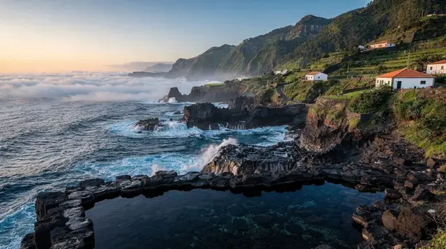
Faial lies on the north-east coast, between /destinations/porto-da-cruz/ and /destinations/sao-jorge/, banana terraces climbing the slopes behind the houses and the Atlantic doing what the Atlantic does on this side of the island: arriving unfiltered, with nothing between Faial and the coast of mainland Portugal but open water. The village itself is modest — a church, a football pitch improbably wedged onto a plateau above the river mouth, a scatter of cafes — and it would barely register on a first-timer’s itinerary if it weren’t standing directly beneath the Penha de Aguia.
The Penha de Aguia, Madeira’s Eagle Rock
The Penha de Aguia (literally the Eagle Rock, and locally just “a Penha”) is a bare, near-vertical wall of volcanic rock rising straight out of the sea on the boundary between Faial and Porto da Cruz. It reaches roughly 590 metres, which sounds unremarkable on paper until you’re standing at its foot and realise the whole thing is one uninterrupted lump of basalt with almost nothing growing on its seaward face. From the coast road it looks less like a hill than a wall that’s been dropped into the landscape at the wrong angle.
This is the single most important thing to get right about the Penha de Aguia, and it’s the mistake that trips up first-time visitors reading about it online: it is not a summit you drive to. There’s no viewpoint car park at the top, no road switching back and forth up its face the way the route to /destinations/pico-do-arieiro/ climbs into the central mountains.
The rock sits at sea level relative to the road, which makes it look approachable, but the only way onto it is on foot, on a narrow, signed path that either skirts its base or climbs partway up its northern flank. Anyone expecting a Pico do Arieiro-style drive-up viewpoint here will be disappointed; anyone expecting a short, sharp walk to a genuinely dramatic vantage point will not be.
Walking around — or up — the rock
The path that circles and partly climbs the Penha de Aguia starts from the edge of Faial village, near the football ground, and is well enough marked that you won’t need a guide, though you do need proper footwear: the surface alternates between packed earth, exposed rock and short, loose sections where a trekking pole helps more than you’d expect for something this short. Allow one to two hours for the loop out and back, depending on how far up the flank you go and how long you linger at the viewpoints.
There are two things worth knowing before you set off. First, Madeira’s paid-trail system, in force since August 2021, covers the island’s official waymarked network, and coverage of the smaller north-coast paths has widened since the rule was introduced — so treat the Penha de Aguia path as part of that system rather than assuming it’s exempt, and check the current listing at simplifica.madeira.gov.pt before you go.
Where it applies, the fee runs to roughly EUR 3 per person, per trail, per day, and wardens do check. Second, and unrelated to cost: this coast catches wind and cloud that the sheltered south rarely sees, and the exposed sections near the top are not the place to be caught out by either. If the rock’s summit is wrapped in cloud from the road, it will be worse up there.
For a longer version of the same idea, the /things-to-do/porto-da-cruz/ side of the rock connects into walking routes that run further along the coast, and travellers building a proper hiking week around the island’s shorter, less-crowded trails should look at a private guided walk along the Vereda do Larano, which threads the cliffs just along the coast from Faial and gives a longer, guided alternative to going it alone.
What Faial village actually offers
Away from the rock, Faial is not a destination that fills a full day on its own, and it doesn’t pretend to be. What it does have is a genuinely local feel that’s increasingly hard to find on the busier stretches of the island: banana and passion fruit terraces worked by the same families who’ve worked them for generations, a river mouth where local kids swim in summer, and a couple of unpretentious cafes serving the kind of simple, inexpensive food aimed at Madeirans rather than tour groups. If you want twenty minutes of coffee and quiet before or after the walk, this is where to get it.
The village also makes a sensible base for reading the geography of this whole stretch of coast. Standing on the seafront looking east, you can see how the north coast alternates between sheer rock and small, sheltered river-mouth settlements — Faial, then Porto da Cruz just around the headland, then the terraced slopes climbing toward /destinations/santana/ further along. It’s a useful, low-effort way to understand why this side of the island developed so differently from the resort coast around Funchal: steep terrain, heavy rainfall and no easy harbours kept the north agricultural and quiet long after the south turned to tourism.
Getting there and combining it with the rest of the north coast
From Funchal, Faial is a 50 to 60 minute drive, mostly on the VE1 expressway, which tunnels through the mountains and along the coast before dropping you onto the older coastal road for the final approach into the village. That older road is worth taking slowly rather than rushing past on the expressway: it’s one of the few remaining stretches where you drive right beneath the Penha de Aguia rather than through the hill it stands on.
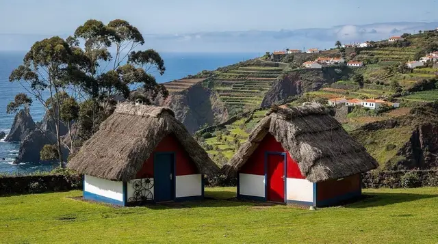
Faial pairs naturally with two very different kinds of onward route, and it’s worth deciding which one you want before you set off, because they pull in opposite directions. Heading east and further along the coast takes you toward /destinations/sao-jorge/ and the thatched-roof village of /destinations/santana/, both easy additions to a north-coast day.
Heading south instead, the road climbs inland into the mountains toward /destinations/ribeiro-frio/ and the /destinations/balcoes/ viewpoint — a different region of the island altogether, deep in Madeira’s central massif rather than on its coast, and covered in full on its own page rather than here. Treat it as a possible extension of the day if you’re driving yourself and have time, not as part of the same outing: the driving character changes completely once you leave the coast road and start climbing.
If you’d rather not navigate the coast road and the switchbacks inland yourself, a guided private 4x4 tour of the north-east coast covers Faial, Porto da Cruz and the villages around them without you having to think about parking or oncoming traffic on the narrower sections, and it’s the option most first-time visitors to this side of the island end up choosing.
Comparing your options for seeing this stretch of coast
| Option | Time needed | Roughly | Best for |
|---|---|---|---|
| Self-drive, Faial only | 2-3 hours | Fuel + parking | Independent travellers with a hire car already |
| Self-drive, Faial + Santana | Half day | EUR 40-70 pp | Combining the rock with the thatched houses |
| Guided north coast 4x4 tour | Full day | Fixed per person | Travellers without a car, or nervous about the coast road |
| Emerald Forest 4x4 tour with waterfalls | Full day | Fixed per person | Pairing the north coast with inland waterfalls in one trip |
What not to expect
Set expectations correctly and Faial delivers exactly what it promises: a striking rock, a short walk, and a quiet village that hasn’t been rebuilt around tourism. Set them wrong and it disappoints. Don’t come expecting a road to the top, a cable car, or a manned viewpoint with a cafe and a car park — none of that exists here, and it’s part of what keeps the place uncrowded.
Don’t assume the path is free simply because it’s short: Madeira’s trail-fee system applies by trail, not by length, so check before you go rather than at the checkpoint. And don’t treat this as a substitute for the /destinations/balcoes/ or /destinations/ribeiro-frio/ side of the island — they sit inland, in the mountains, and involve an entirely different drive and a different kind of scenery.
Faial and the Eagle Rock: your questions answered
Can you drive to the top of the Penha de Aguia?
No. There is no road to the summit or upper flank of the Penha de Aguia. The only access is on foot, via a marked path that starts near Faial village and either circles the rock’s base or climbs partway up its northern side. Anyone selling or describing a drive-up viewpoint here has confused it with a different location.
Is the walk around the Penha de Aguia paid, like the levadas?
Treat it as covered by Madeira’s official paid-trail system, in force since August 2021, which now extends to most of the island’s waymarked network including several north-coast paths. Expect a fee of roughly EUR 3 per person, per trail, per day, bookable at simplifica.madeira.gov.pt, and check the current listing before you set off rather than assuming a short path is exempt.
How long does the walk take?
Budget one to two hours for the loop from Faial village, depending on how far up the rock’s flank you go and how long you stop at the viewpoints. It’s a short outing by Madeira standards, easily combined with a morning or afternoon in /destinations/santana/ or /destinations/porto-da-cruz/ on the same day.
Is Faial the same area as Ribeiro Frio and the Balcões viewpoint?
No, and this is a common mix-up. Faial and the Penha de Aguia sit on the north coast at sea level. Ribeiro Frio and the /destinations/balcoes/ viewpoint sit well inland, high in Madeira’s central mountains, reached by a different, climbing road. They can be combined into one long day if you’re driving, but they are separate regions of the island with separate weather and separate driving conditions.
How do you get to Faial from Funchal without a hire car?
The public bus network reaches the north coast, but connections to Faial specifically are infrequent and not built around tourist schedules. Most visitors without a car join a guided /things-to-do/porto-da-cruz/ or wider north-coast excursion instead — see the tour options above — or arrange a private transfer.
What’s the weather like at Faial compared to Funchal?
Expect it to be cooler, cloudier and wetter than Funchal on the same day. The north coast catches the moist air the mountains trap before it reaches the sheltered south, and the Penha de Aguia itself often holds cloud against its upper face even when the coast road below is clear. Check conditions on the day rather than assuming Funchal’s forecast applies here — see /guides/driving-in-madeira/ for more on how quickly conditions change across the island.
Is there anywhere to eat in Faial itself?
Yes, but keep expectations modest and local: a handful of simple cafes and a bar or two around the village centre, serving straightforward Madeiran food rather than a tourist menu. It’s a good stop for coffee or a light lunch before or after the walk, not a destination for a long, planned meal — save that for Santana or Porto da Cruz.
Can you combine Faial with a Pico Ruivo or Pico do Arieiro trip in one day?
It’s possible if you’re driving and starting early, since a transfer service between Machico and Pico Ruivo or Pico do Arieiro shows how the roads connect, but treat it as a long, full day rather than a relaxed one: the mountain roads and the coast road demand different kinds of driving, and cloud in the mountains often builds through the afternoon. For most visitors, splitting the north coast and the high peaks across two separate days works better. See /guides/north-madeira-day-trip/ and /itineraries/madeira-hiking-week/ for ways to plan around that.