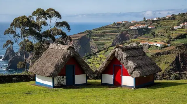
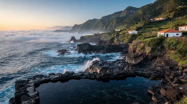
For most visitors, Serra de Água is somewhere you pass through rather than somewhere you plan a whole day around — and that undersells it slightly. This valley village and the mountain road that climbs out of it, over the Encumeada pass, are the classic way to feel Madeira’s interior close up: steep green walls, water everywhere, and a road that never lets you forget you are crossing a volcanic island rather than driving between two towns on a map.
Where Serra de Água sits
Serra de Água lies in a narrow valley on the south-west of Madeira, a short climb inland from Ribeira Brava and close to Campanário. It sits at the southern foot of the road that leads up to the Encumeada pass, the low point in the island’s central mountain ridge where the south and north coasts come closest together. On a map, the distance from here to São Vicente on the north coast looks short. On the road, it is a different story: the ridge in between is steep and folded, and the only way across by car is this single winding route, climbing through forest before dropping again on the far side.
That geography is the whole reason Serra de Água matters to a visitor. It is the gateway to the interior for anyone based on the south or west coast, whether the destination is São Vicente and its lava caves, the plateau beyond, or simply the pass itself as a viewpoint and a change of air.
The village itself
Serra de Água is small: a scatter of houses along the valley floor, terraced plots climbing the slopes on either side, and the sound of running water that gives the place its name — “mountain of water” is roughly the sense of it, and it fits. There is a government-run pousada here with a swimming pool built into the hillside, a handful of cafés and small restaurants serving straightforward Madeiran food, and little in the way of formal sightseeing.
That is not a criticism. This is a working valley, still partly cultivated, and its appeal is the setting rather than any single attraction: steep basalt walls closing in on both sides, banana and vegetable terraces wherever the slope allows, and cloud that regularly sits on the upper ridges while the valley floor stays clear. It is worth slowing down for even if you are only passing through on the way to the pass.
a guided levada walk that follows the contour path above the village is the easiest way to get out of the car and into the landscape here, following a water channel along the hillside with views back down the valley rather than tackling the road itself on foot.
Driving the Encumeada road
This is the point worth repeating clearly: the road from Serra de Água up to the Encumeada pass is a mountain road, not a fast one. It is narrow — often down to a single usable lane on the tighter bends, with passing places rather than a continuous two lanes — and it climbs in a long series of switchbacks through eucalyptus and then native forest as the altitude increases. It has nothing in common with the VR1, the coastal expressway that tunnels through the headlands further down towards Ribeira Brava; that road is built for speed, this one is not, and mixing the two up in your head before you drive it is the single most common way to be caught off guard.
Expect a drive in low gear for long stretches, blind corners where a horn tap before the bend is standard local practice, and a genuine drop in temperature and visibility as you gain height. Cloud can sit over the upper section of the road even when the coast below is in full sun, so headlights on and a steady pace matter more than they would on the same distance at sea level. None of this makes the road dangerous when driven carefully, but treating it as a quick cut-through between coasts is the mistake that catches people out — budget real time for it, not a glance at the map distance.
A small hire car handles these hairpins far more comfortably than anything larger, and this is one of the clearest examples on the island of why that advice holds.
At the top: the Encumeada pass
The road crests at the Encumeada pass, at roughly 1,000 metres, close to the point where Madeira’s central ridge is at its lowest and narrowest. There is a signed viewpoint with parking, and on a clear day the ground drops away on both sides at once — south towards Serra de Água and the coast you have just climbed from, north towards a wooded valley leading down to São Vicente. On a cloudy day, which is common here regardless of the weather at sea level, you may get little more than mist and the shapes of trees close by. Treat any view from the pass as a bonus rather than something to plan around.
The pass is also a junction point for hikers, with paths leading off into the surrounding laurissilva forest and onward towards the ridge that eventually reaches Paul da Serra. Most visitors experience it from the car, stepping out for photographs and the cooler air before continuing, but it is a legitimate stop in its own right if the cloud has lifted.
Walking near Serra de Água
Beyond the levada path directly above the village, this stretch of the west is within easy striking distance of several of Madeira’s better-known walks, and using Serra de Água as a base rather than a stopping point is a reasonable way to plan a day. Rabaçal and its levadas, including the well-known routes towards 25 Fontes and Levada do Risco, sit further up towards the plateau and are covered in full on their own guide, along with the shuttle arrangement and the hiking permit that now applies to Madeira’s official PR trails.
Serra de Água itself is not one of those numbered PR routes, so the permit system does not apply here, but it is worth knowing about before continuing further into the interior — see the guide to hiking permits and trail fees if that is part of your plan.
For something a little further afield and less on foot, a scenic hike to some of the island’s lesser-known waterfalls covers ground away from the busiest levadas, which suits travellers who have already done the headline walks and want somewhere quieter.
Continuing north, or looping back west
Crossing the Encumeada pass and dropping down the far side brings you to São Vicente, with its volcanic caves and a coastline that feels distinctly different from the south — wetter, greener, and shaped by a completely different weather pattern. This south-to-north crossing, done as a there-and-back or as part of a longer loop, is one of the most efficient ways to see both faces of the island in a single day, and it is covered in more general terms in the guide to north versus south Madeira.
An alternative from Serra de Água is to continue up towards the Paul da Serra plateau and on to Fanal, rather than dropping to the north coast — though both of those have their own character and their own dedicated pages, since neither is really part of the valley-and-pass story told here.
If your day is built around the west coast rather than a full crossing, looping back down towards Calheta, Jardim do Mar or Paul do Mar makes for a full circuit that touches sea level, valley, and mountain pass in a single outing — broadly the shape covered in the west Madeira day trip guide.
Travellers who would rather leave the hairpins to someone else can cover similar ground with a full-day 4x4 safari through the west of the island, which typically threads together several of the same valleys and viewpoints without anyone in the group needing to watch the road.
Where to eat and stop
Serra de Água’s few restaurants lean towards solid, unfussy Madeiran cooking — espetada, grilled fish, and dishes built around the valley’s own vegetables — rather than anything aimed squarely at passing tourists, which is part of its appeal if you want a proper lunch break rather than a quick coffee. The pousada’s terrace, looking back down the valley, is a pleasant spot to sit for twenty minutes before tackling the climb to the pass.
There is little reason to linger for a full evening here unless you are staying locally; most visitors treat it as a midday stop on a longer loop rather than a base for several nights, with Ribeira Brava or Calheta offering more choice for an overnight stay.
Practical information
| From Serra de Água | Approximate drive time | Notes |
|---|---|---|
| Funchal | 35–45 minutes | Mostly VR1, then a short climb |
| Ribeira Brava | 10–15 minutes | Short, still winding |
| Encumeada pass | 15–20 minutes | Continuous climb, narrow road |
| São Vicente | 35–45 minutes total from Serra de Água | Via the Encumeada pass |
| Paul da Serra turn-off | 25–35 minutes | Continuing past the pass |
| Typical costs | Range | |
| Small hire car, per day | €30–50 | |
| Fuel for a valley-and-pass loop | €10–15 | |
| Lunch in Serra de Água | €12–20 per person | |
| Guided levada walk near the village | Varies by operator |
These are rough planning figures rather than fixed prices, and they assume a self-drive visit rather than an organised tour, where transport and guiding are bundled into a single cost.
Best time to visit
April to October generally gives the clearest run over the pass, though cloud can settle at any time of year regardless of the season — this is one of the more weather-dependent stops on the island precisely because of the altitude, and the mountain weather guide is worth a look before you set off if the pass view matters to you. Winter crossings are perfectly manageable in a car but more likely to mean mist rather than a view from the top, and an early start tends to beat the cloud that often builds through the middle of the day.
For travellers who would rather have someone else navigate the hairpins while keeping half an eye on the weather, a private guided walk further along the west coast is a way to combine this region’s levadas with local knowledge of which day is actually worth the drive.
A stop, not a summit
Serra de Água and the Encumeada road will not be the photograph most visitors remember Madeira by — that is more likely to come from the Pico do Arieiro sunrise or the cliffs at Cabo Girão. What this valley and its road offer instead is the clearest sense on the island of how compressed Madeira’s geography really is: sea-level heat, a folded green valley, and cool cloud-wrapped forest, all inside a drive of well under an hour. Treat the road as part of the experience rather than an obstacle between two better destinations, and it earns its place on the route.
Frequently asked questions about Serra de Água and the Encumeada road
Is the Encumeada road difficult to drive?
It is narrow and winding rather than technically dangerous. Expect tight hairpins, sections wide enough for one car at a time, low cloud that can drop visibility with little warning, and a much slower pace than the coastal VR1. Take it steadily, use your horn on blind bends, and do not expect to cover the distance quickly.
How long does it take to drive from Funchal to Serra de Água?
Around 35 to 45 minutes on a clear day, mostly on the VR1 with its coastal tunnels as far as Ribeira Brava, then a short climb into the valley. Add extra time if you plan to stop at viewpoints or if cloud has settled over the mountains.
Can you stop at the Encumeada pass?
Yes. There is a signed viewpoint and parking area at the top of the pass, roughly at the boundary between the south and north of the island, with a short path leading to wider views when the cloud allows. It is also a junction for hiking routes into the surrounding laurissilva forest.
Is Serra de Água worth a stop on its own?
It is a quiet, green valley village rather than a headline sight, so it suits travellers who want a break from driving, a short walk, or a base for exploring the west coast rather than a must-see attraction in its own right.
What is the weather like at the Encumeada pass?
It is consistently cooler and cloudier than the coast, since the road climbs to around 1,000 metres. Mist can sit over the pass even on a sunny day at sea level, so pack a layer and expect the view to be unreliable rather than guaranteed.
Do I need a 4x4 for this road?
No. The Encumeada road is a paved public road that any standard hire car can manage. A small car is easier to handle on the hairpins than a large one, but four-wheel drive is not required for the road itself.
Is there a levada walk at Serra de Água?
Yes, a levada path contours the hillside above the village and is covered by a dedicated guided walk, which is a gentler way to experience the valley than driving straight through it.
Can I combine Serra de Água with São Vicente in one day?
Yes, this is one of the most common half-day loops on the island: south coast to Serra de Água, over the Encumeada pass, down into São Vicente, and back along the north or west coast. Allow a full half day once stops are included, since none of the roads on this route are fast.