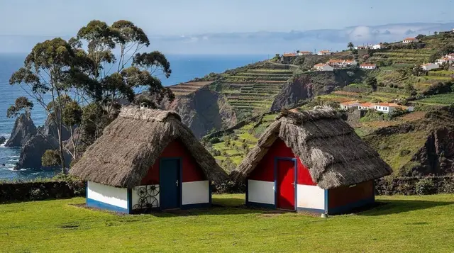
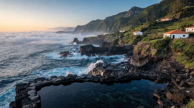
A green plateau above the east coast
Drive up from Machico or Santa Cruz on a clear, sunny afternoon and within twenty minutes the light changes. The road climbs through eucalyptus and pine, the air cools, and by the time the first golf greens appear at Santo da Serra you may well be driving through drizzle or a low, drifting cloud. This is the single most useful thing to understand about the plateau: it does not share the coast’s weather, and it never has.
Santo da Serra sits at roughly 660–700 metres above sea level on the high ground east of Camacha, a short hop from Machico and Santa Cruz as the crow flies but a different climate entirely. It is not a village built for tourism the way Funchal or Câmara de Lobos are.
It is a working parish with a golf course, a municipal park, patches of forest and pasture, and a scattering of quintas — country houses — that were once summer retreats for Funchal’s merchant families escaping the coastal heat. That history explains the parkland feel today: this was always meant to be somewhere cooler to withdraw to, not somewhere to sunbathe.
For visitors, that makes Santo da Serra a specific kind of stop rather than a headline destination. It rewards golfers outright, gives walkers a shaded, temperate alternative to the exposed trails of the west, and gives anyone touring the east coast a fast, concrete lesson in why Madeira’s brochures never quote a single island-wide temperature.
The climate contrast, explained properly
Madeira’s south coast is sheltered, sunny and dry for most of the year; its interior and north are green, cloudier and wetter, because the trade winds push moisture-laden air against the island’s central mountains, where it condenses. Santo da Serra sits close enough to that dividing line, and high enough, to feel the difference sharply even though it is barely a twenty-minute drive from the coast.
Practically, this means: do not assume the forecast for Santa Cruz or Funchal applies here. It is entirely normal for the coast to be in bright sun at 24°C while Santo da Serra sits under cloud at 16–18°C with a fine mist falling. Locals describe it plainly — the plateau “makes its own weather” — and the golf course’s own maintenance staff will tell you the greens stay green here for exactly that reason.
If you are driving up specifically to walk or play golf, check conditions for Santo da Serra itself, not for the coastal town you are leaving. A dedicated guide to Madeira’s mountain weather is worth reading before any trip inland, and applies just as much to this modest plateau as it does to Pico do Arieiro further west.
Pack accordingly: a light waterproof and a layer warmer than you think you’ll need, even in summer, even if you left the coast in a t-shirt. Footwear that can handle wet grass and mud matters more here than sun cream.
| Location (same afternoon) | Typical feel | Elevation |
|---|---|---|
| Santa Cruz / coast | Sunny, dry, breezy | Near sea level |
| Santo da Serra | Cool, often cloudy, damp | ~660–700 m |
| Pico do Arieiro (for scale) | Cold, often above the clouds | 1,818 m |
Golf: the main reason most visitors come
Santo da Serra Golf Club is the best-known 27-hole course on the island and the main draw for a large share of its visitors. It was designed with the site’s rolling, forested terrain in mind rather than flattened for the purpose, so fairways run between mature trees with the odd sea view opening up to the east on a clear day. Serious golfers plan a Madeira trip around a round or two here; casual visitors sometimes simply stop at the clubhouse for a coffee and to watch play from the terrace.
Because the course sits at altitude, the same rule applies as everywhere else on the plateau: check the weather for Santo da Serra specifically before booking a tee time, not the forecast for wherever you’re staying on the coast. Cloud and light rain do not always close the course, but they change the experience considerably.
Walking the parkland and forest
Away from the fairways, Santo da Serra has a municipal park with mature trees, azaleas and hydrangeas that put on a strong show in late spring, plus patches of forest walking that feel closer to a temperate European wood than anything on Madeira’s sunbaked south coast. This is not a levada destination in the way Ribeiro Frio or the Levada dos Balcões are, and there is no ticketed official trail centred on the settlement itself — walking here is informal, on park paths and quiet lanes rather than a numbered PR route with its own permit fee.
If you want a proper levada walk on the same excursion, the closest options are west toward Ribeiro Frio, where the short, well-known Levada dos Balcões gives one of the best payoff-to-effort views on the island, or further afield toward Caldeirão Verde from the Queimadas. Both require the standard official-trail permit; Santo da Serra’s own paths do not, since they are park and lane walking rather than a PR-numbered levada route. For anyone unsure of the difference, our guide to hiking permits and trail fees sets out exactly which walks are ticketed and which are not.
a guided levada walk that takes in the cooler, greener interior scenery this part of the island is known for is a straightforward way to see this side of Madeira without navigating permits or route-finding yourself.
Getting here and combining it with the east
Santo da Serra sits on the road network linking Camacha to Machico, which makes it a natural add-on to an east-coast day rather than a standalone trip. From Funchal, the drive takes roughly 35–45 minutes via the ER102, climbing steadily out of the city through Camacha’s wicker-weaving country. Public transport reaches the area but infrequently; a hire car is the practical way to visit, and our guide to driving in Madeira covers what to expect on these inland roads — narrower, wetter and with less visibility in cloud than the sun-drenched coastal VR1.
A logical loop for the day: start at Machico or Canical on the coast, drive up to Santo da Serra for golf, a walk or simply lunch with a view of the changing sky, then either continue to Camacha for wicker workshops or drop back down to the coast before the afternoon cloud thickens further.
Many visitors pair the plateau with a wider look at the east on an organised trip; a private guided tour of the east that also stops at a rum distillery covers ground you would otherwise need a full day to piece together yourself. For something more active that touches the island’s interior forests and viewpoints in one outing, a jeep tour through the eastern forests toward Santana and Pico do Arieiro gives a wider sweep of the terrain that surrounds Santo da Serra, at a faster pace than a self-drive loop.
If your priority is simply seeing more of Madeira’s varied trail network on the same trip, a guided trail experience covering some of the island’s classic walking routes is worth booking ahead, since it takes the guesswork out of permits, transport to trailheads and route safety in changeable weather — exactly the conditions this plateau is known for.
What to eat and where to pause
Santo da Serra is not a food destination the way Câmara de Lobos or Funchal’s old town are, but the golf clubhouse and a handful of small local restaurants serve solid, unfussy Madeiran fare — soup, grilled fish or espetada, and coffee strong enough to shake off the damp. It is a good, quiet place to break a longer east-coast drive rather than a culinary stop in its own right. For an island-wide primer on what to order and where, see our Madeira food guide and the companion piece on espetada and bolo do caco.
Photography and viewpoints
On a clear morning, before cloud typically builds through the day, Santo da Serra’s high ground offers glimpses east toward Machico and the airport peninsula, and the forested parkland itself photographs well in soft, diffused light — precisely the kind of overcast conditions that ruin a coastal beach shot but flatter green landscape and woodland. Photographers chasing the island’s famous cloud-forest look sometimes prefer Santo da Serra to the more crowded Fanal simply because it is closer to the coast and easier to reach on a whim when the weather turns. Our photography spots guide has more on timing shots around Madeira’s shifting cloud line.
Where Santo da Serra fits on a wider itinerary
Because it demands only a few hours, Santo da Serra works best folded into a broader east-coast day rather than visited alone. Pair it with Ponta de São Lourenço for a total contrast — arid, treeless peninsula versus damp green plateau, both within the same short region — or with Santa Cruz and Canical for a coast-to-interior loop that shows off the island’s range in a single day. Our east Madeira day trip guide and general east-versus-west comparison set out fuller routes if you want to plan the whole day rather than just the plateau detour.
Santo da Serra FAQ
Is Santo da Serra worth visiting if I don’t play golf?
Yes, but treat it as a half-day detour rather than a destination. The parkland, forest walks and cooler air make a pleasant contrast to the coast, and it’s an easy add-on to an east-coast drive, but there is little to fill a full day here without golf.
Why is it colder at Santo da Serra than on the coast nearby?
Santo da Serra sits at roughly 660–700 metres, high enough to catch the moist trade winds that Madeira’s mountains trap and condense into cloud and rain. The coast a short drive below sits in the rain shadow and stays sunnier and drier, so the two can have completely different weather on the same afternoon.
Do I need a hiking permit to walk at Santo da Serra?
No. Walking around the park and parkland at Santo da Serra is informal, on paths and quiet lanes, not a numbered official PR trail. The paid permit system applies to Madeira’s official levada and mountain trails, such as those toward Ribeiro Frio or Caldeirão Verde, not to the plateau’s own park walks.
How do I get to Santo da Serra from Funchal?
By hire car, in roughly 35–45 minutes via the ER102 through Camacha. Public transport exists but is infrequent, so a car is the practical option, especially if you’re combining the visit with other east-coast stops the same day.
What should I pack for a visit here?
A light waterproof and a warmer layer than the coastal forecast would suggest, plus footwear that can handle wet grass. Even a t-shirt afternoon in Santa Cruz or Funchal can mean cloud and light rain up at Santo da Serra.
Can I combine Santo da Serra with a levada walk?
Yes, but the nearest ticketed levada routes, such as the Levada dos Balcões near Ribeiro Frio, are a separate drive rather than in the village itself. Plan Santo da Serra and a levada walk as two stops on the same day rather than expecting one at the other.
Is Santo da Serra the same as Santa Cruz?
No. Santa Cruz is a coastal town near Madeira’s airport with its own distinct sunny, dry climate; Santo da Serra is an inland plateau roughly 660–700 metres higher, with a noticeably cooler and wetter climate. They are covered on separate pages because they behave, and feel, like different places.
What is the best time of year to visit?
May to September gives the best odds of a clear morning, though cloud can build any day, at any time of year, on the plateau. If golf or a specific view is the priority, check a same-day forecast for Santo da Serra itself rather than relying on a general seasonal guide.